Skip to product information
1 of 5

3DMakerpro Eagle LiDAR 3D Scanner

3DMakerpro Eagle LiDAR 3D Scanner

Regular price $3,158.00 USD
Regular price $3,998.00 USD Sale price $3,158.00 USD
Sale Sold out
Shipping calculated at checkout.

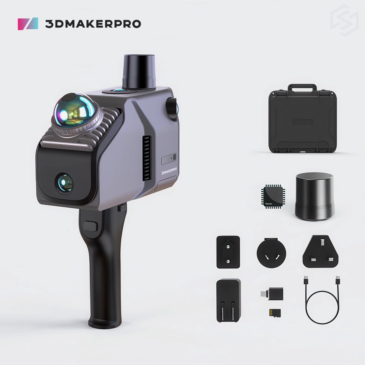
The 3DMakerpro Eagle LiDAR Scanner delivers all-in-one, high-precision LiDAR scanning with wide-area coverage and up to 8K HDR imaging for vivid colors, enabling fast and detailed large-scale 3D scene capture in just minutes. 48MP camera delivers fisheye detail—4 cameras for Max and 1 camera for Standard.

Every Eagle model includes an RTK (Real-Time Kinematic) module, enhancing positioning accuracy through real-time differential correction to achieve absolute point cloud accuracy within 1–3 cm for precise large-scale 3D mapping.

Model
Quantity

3DMakerpro

Product Brochure

System Requirements

Configuration
  • 8 Cores @ 2.4GHz, 32GB (TF card expansion supported)
Recommended Configuration
  • Processor: Intel Core i7
  • Memory: 64GB RAM
  • Graphics Card: NVIDIA RTX 4060, 16GB VRAM
Minimum Configuration
  • Processor: Intel Core i7
  • Memory: 32GB RAM
  • Graphics Card: NVIDIA RTX 3060, 12GB VRAM
Note
  • Gaussian Splatting is only supported on NVIDIA GPUs.

Output Format

  • 3D Color Point Cloud (PLY)
  • 3D Gaussian Splatting (PLY)
  • 3D Colored Polygonal Model (OBJ)
  • 3D Panoramic Tour Data (OBJ)
View full details

Meet the Eagle LiDAR Scanner

Eagle delivers high precision, expansive coverage, and effortless operation. Engineered for professionals, it offers a complete, end-to-end workflow — from capture to 3D production — making large-scale scene modeling fast and seamless for applications such as architectural surveying, film production, and virtual exhibitions.

Eagle Demonstration

See for yourself how an outdoor scene can be transformed into a 3D environment using 3DMakerpro Eagle.

70 Meters Scanning Radius

Provides a scanning radius of up to 70 meters under 80% reflectivity conditions.

Up to 2 cm Accuracy

Achieves scanning accuracy of up to 2 cm at a 10-meter distance.

8K HDR Imaging

Outputs 8K HDR imaging for vivid colors and dynamic range.

Why Choose the Eagle LiDAR?

High-Precision, Wide-Range Scanning

Powered by an advanced LiDAR engine, Eagle captures expansive spaces at ultra-fast speeds, turning buildings and entire streets into professional-grade 3D models in just minutes.

Ultra-Wide Coverage Angle

Eagle’s LiDAR offers a 360°×59° field of view, delivering 30% more coverage than typical scanners. Just one simple rotation is enough to capture an entire room.

3D Gaussian Splatting

Eagle converts photos into realistic 3D scenes using Gaussian Splatting, producing high-quality, Unreal Engine–compatible content for rapid environment creation.

Adaptable to Various Platforms and Vehicles

Eagle captures up to 200,000 points per second, preserving data quality even at speeds of 20 km/h, supporting dynamic operations across different vehicles.

Immersive Panoramic 3D Environment Tours

Create immersive panoramic tours that make your audience feel like they’re truly there.

Post-Processing Software for 3D Point Cloud Editing

The post-processing software that is included with the scanner allows you to refine and edit point cloud data, with output formats including PLY, PNG+OBJ, and Gaussian-Splatting PLY (completely free of charge for non-commercial visual sharing). Export to popular platforms such as Revit, Unreal Engine, and Blender. Simplify your workflow from raw scan to final model with intuitive editing tools.

Building and Surrounding Grounds

Interior Room

Eagle vs. Raven

The 3DMakerpro Raven and Eagle are both professional LiDAR 3D scanners with the same accuracy of 2 cm at 10 m. The main difference is that Eagle features more cameras and captures more data for high-detail reality capture, while Raven is lighter, more portable, and equipped with a larger, brighter AMOLED screen and a 12,000 mAh swappable battery for extended mobile indoor/outdoor scanning.

Eagle
Eagle
Raven
Raven
Accuracy 2 cm @ 10 m; 3 cm @ 20 m; 5 cm @ 40 m
Point Cloud Frequency 200,000 points/s 150,000 points/s
Scanning Radius 70 m 50 m
Camera 48 MP system with 8K panoramic capability 1/2-inch 12MP Sony sensor, generating HD color point clouds and 4K Gaussian Splatting, and supports optional external 360 cameras.
Battery 12,000 mAh battery
Up to 1 hour of operation
Supports external power while charging
12,000 mAh swappable battery
Up to 2 hours of operation
Supports external power while charging
Screen 3.5" screen 3.9" AMOLED HD touchscreen
Weight 1.5 kg 1.1 kg
Best For High-density capture for complex indoor structures Lighter, portable solution for indoor and outdoor mapping

Technical Specification

* provided by 3DMakerpro

LiDAR Scanner
Accuracy 2 cm @ 10 m; 3 cm @ 20 m; 5 cm @ 40 m
Scan Radius 40–70 m (measured at >10% or >80% reflectivity)
Scan Range 80–140 m
Scan Angle Horizontal 360°, Vertical 59°
Point Cloud Frequency 200,000 points/second
Laser Light Source 905 nm
Eye Safety Class 1 (IEC60825-1:2014)
HDR Mode Supports 3–5 EV
Color Texture
  • Max Edition: 4 × 48 MP fisheye cameras
  • Standard Edition: 1 × 48 MP fisheye camera
Image Quality Output 8K Panoramic Color Output
Data Interface USB Type-C × 2
Network Support Wi-Fi 5
Screen 3.5"
Output Formats 3D Color Point Cloud (PLY);
3D Gaussian Splatting (PLY);
3D Colored Polygonal Model (OBJ);
3D Panoramic Tour Data (OBJ)
Built-in Battery 12,000 mAh (supports 1 hour of work; external power supply supported)
Dimensions 115 × 181 × 106 mm
Weight 1.5 kg

FAQ

Is scanning software included?

Yes. Free basic scanning software is provided to process your scan data. For advanced editing and cloud-based exhibitions, additional paid software options are available.

What are the application scenarios?

Eagle is ideal for architecture and engineering, real estate and interior design, film and television production, game development, cultural heritage preservation, surveying, mapping, and more.

Is the laser safe for humans?

Yes. The laser meets Class 1 laser safety standards (IEC 60825-1:2014) and is safe for the human eye under normal operating conditions. However, prolonged direct exposure should be avoided.

What is RTK and what does it do?

RTK (Real-Time Kinematic) is a dynamic measurement technology that utilizes carrier phase observation for real-time differential GPS (RTDGPS). It consists of a base station receiver, a data link, and a rover receiver, typically using dual-frequency signals from satellite systems such as GPS, GLONASS, Galileo, and Compass. Our RTK Antenna & Signal Module enhances positioning accuracy through real-time differential correction, achieving absolute point cloud accuracy within 1–3 cm. This accessory requires a base station and can be calibrated using wireless communication on the L1 channel (1575.42 MHz) and L2 channel (1227.60 MHz).